MOBILE APP
Easy and intuitive to use tool with a friendly interface. Optimized for mobile devices for field work tasks.
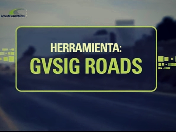
gvSIG Roads is a full solution, which allows the management of the roads infrastructures both from its alphanumeric and geographical component, based on standards and free software.
Deploying gvSIG Roads gives you a complete management system for the conservation and inventory of roads integrated with the features of the Spatial Data Infrastructures.
Easy and intuitive to use tool with a friendly interface. Optimized for mobile devices for field work tasks.
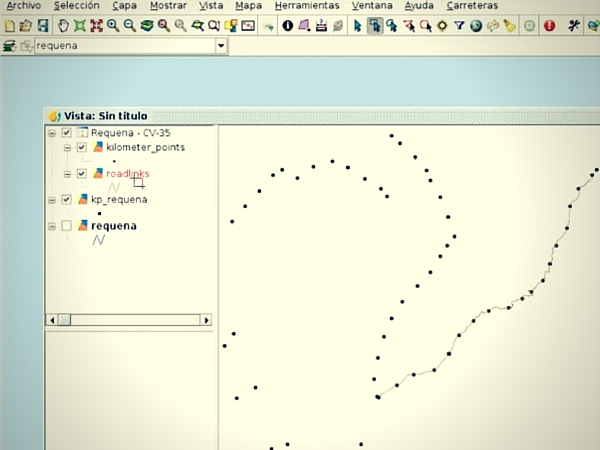
It provides access to resources and services based on geographic information. It allows management, editing and visualization of the roads geospatial data.
A powerful, easy-to-use, interoperable GIS for both editing and maintenance of cartography with all sorts of tools for analyzing and managing geographic information.
It integrates its components as a web management application that allows companies a quick and easy control of project management.
Great, good choice!
It incorporates functionalities of graphic character that contribute the GEO concept as well as analysis tools and decision-making.
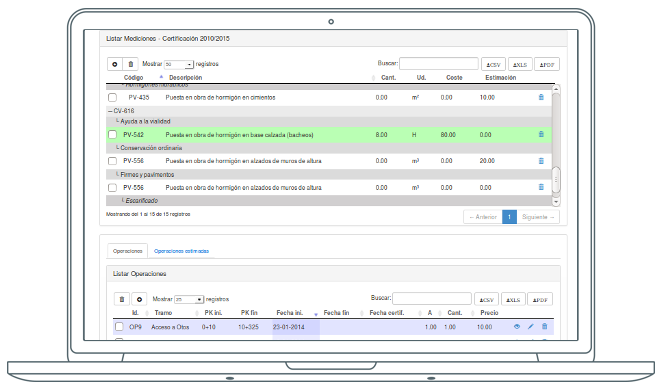
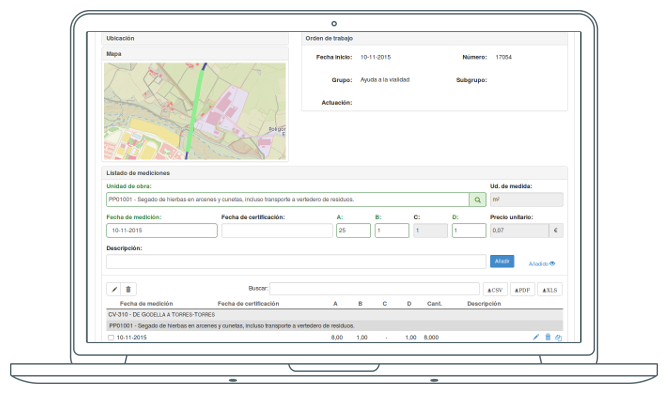
Register measurements and make budgets, managing both the prices per unit of work and management and thus generate the corresponding certifications.
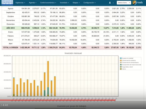
The following graphical reports are available:
The responsible person generates and assigns the work order and keeps track of the incidence.
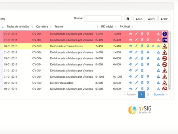
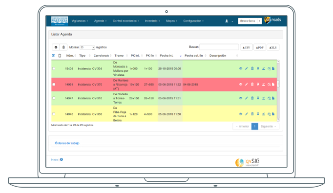
The incidences are classified in states and it is possible to edit, generate reports, generate the work orders by adding pictures of the incident and detailed field work instructions.
Add to the incidence its corresponding measurement and cost estimation. Additionally, this cost is moved to the section of measurements for easier budgeting.
The incidences diary is the tool that the engineer or person in charge of the conservation use daily to access quickly to the incidences.
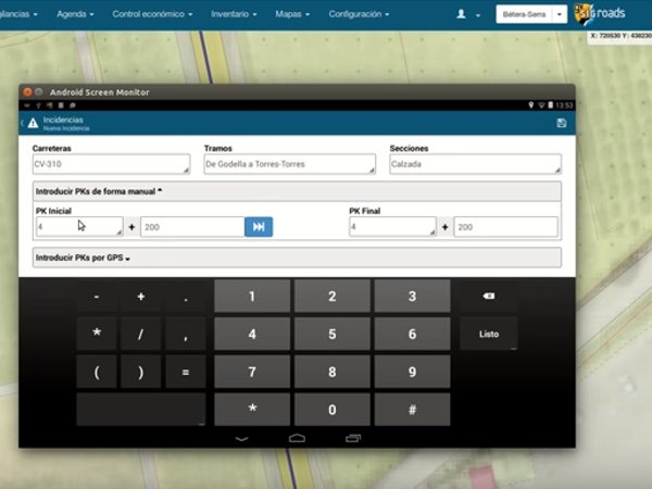
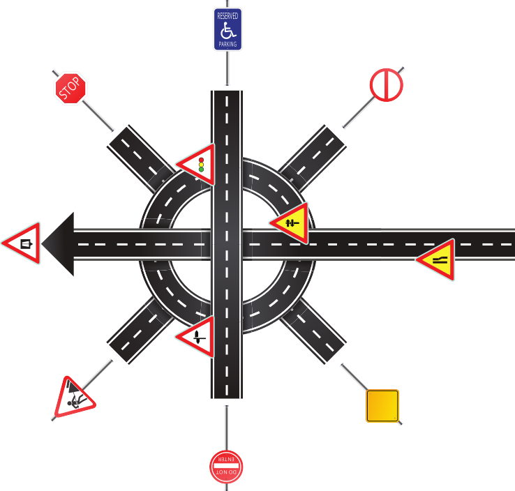
Manually create different types of incidences classified by class, type and subtype, differentiated by color according to resolution and urgency status.
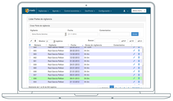
The process starts with a surveillance order, which generates a series of routes and annotations in which several incidences may be found.
It also has an advanced search engine to perform more detailed searches.
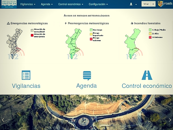
gvSIG Roads has an agenda containing the elements of inventory classified according to their state of conservation: incomplete, affected by an incident, pending update and stable.
Advantages of inventory update flow:
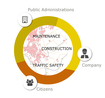
It allows the interaction of different users: administration, contractor, departments, citizens …
With powerful user management by role, gvSIG Roads allows to customize its interface for each type of user.
In this way, gvSIG Roads offers homogeneus working procedures, coherent documentation, coordination with the contractor corporations and easy access to information.
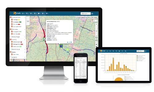
No client installations of the main application, all from a web environment.
This also allows it to be multiplatform and independent of operating system used (Window, Mac, Linux).
Use the GPS on your mobile device, gvSIG Roads lets to work offline in areas without internet coverage.
gvSIG Roads is an easy-to-use tool with a very short learning curve, turning the roads infrastructure management into an intuitive task with thanks to its friendly interface.
It allows for continuous improvement of the platform, adding capacities to manage other areas as well as tailor-made adaptation to the needs of each organization.
gvSIG Roads is an easily scalable solution to new functionalities, not only with tools for the conservation of roads but with utilities to:
Using the most widespread and contrasting technologies, with broad international support, and with a constant evolutionary curve.
Management of incidents, inventory and workflow with gvSIG Roads

Free and interoperable
Software for the management of geographic information with cartographic precision
Tool for rapid Java web application development
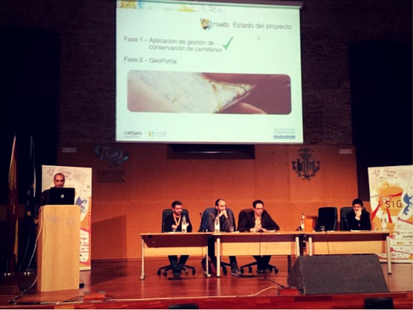
Projects and presentations of gvSIG Roads solution
Great, good choice!
Just call or send us an email, as you wish, and we will get in touch with you as soon as possible.
Subscribe and get your personal access to the application for free.
Moreover, if you register we will keep you informed as to any novelties and special promotions on the tool for the comprehensive management of roads.